Near: Arundel
Level of event: Local
Type of event:
Results
Report
Results now posted.
Many thanks to all competitors for coming to our Event in and around Rewell Quarry.
Thank you to all our helpers, to our organiser Neil and our Planner Jonny for the enjoyable courses with really nice autumn weather.
RouteGadget
Is a web app for sharing and comparing orienteering routes. You can draw your own route or upload a GPS track from your watch. It also allows you to watch an animated replay with a simulated mass start.
Pre event info
Our 2nd event under Covid restrictions will be held at the venue that was successfully used for the middle race of the 2019 Sunny Sussex weekend.
SOG Series Info
SOGs are friendly club events where children and newcomers are very welcome. Yellow and Orange courses are suitable for children to run on their own with a bit of practice. Adults are welcome to shadow children until they are confident to go on their own. Green and Blue courses are run or walked by any age group - you can race competitively or just enjoy the woodland.
There are two series of events - autumn and spring of approximately 8 events each. Electronic timing (SI) is used.
Help on the day always appreciated.
Location Info
Nearest town: Arundel
- Postcode: BN18 0NB *
- Lat,Lng:50.86053,-0.61956
- Grid Ref: SU972076
- Google Map
- Streetmap (OS 50k)
- Bing Map (OS 50k)
- OpenStreetMap
* Postcodes are not very precise in some areas, so don't rely on them for an exact location.
Directions / Parking
The area is accessed from Shellbridge Road (BN18 0ND) about 250m south of its junction with the A29. The route down to the parking follows a 700m gravel track which is uneven in places. Please drive slowly and carefully along this track, if your car has a particularly low clearance underneath you may want to consider not bringing it, or parking on Shellbridge Road and walking in. About 100m along the track there is a parking area which you can use - although the remaining 600m is little different to that first 100m. In that first 100m you may encounter standing water - don't panic it's not very deep. At the low point of the track there is some mud, best to stick to the inside of the bend at this point. Finally there is also a chain across the entrance to the track which we hope to be able to remove, but if not, it is possible to drive over it. Although there are passing spaces on the track we strongly recommend arriving by 11am and not leaving before that time.
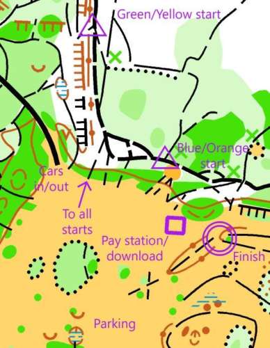
A map of the assembly area can be seen here. Cars will parked end-to-end to facilitate social distancing - please following the parking marshalls' instructions. All competitors head to the starts the same way before splitting to the Blue/Orange and Green/Yellow starts. Both starts and the finish are adjacent to the assembly area.
At all times please respect the golden rules of maintaining at least a 2m distance between yourself and others not in your household/bubble and sanitising your hands before and after handling communal equipment.
Course Information
Blue, 5.2km 70m climb, double-sided map
Green, 3.7km, 50m climb
Orange, 2.4km, 30m climb
Yellow, 1.7km, 20m climb
No loose control descriptions will be provided at the event. They are on the maps and can be downloaded here
Yellow maps should be collected at the pay station
The event has a punching start and finish but all other controls are SIAC enabled.
The start list as of October 9th can be seen here. Please stick to your allocated start window to reduce the risk of overcrowding at the starts.
Entry Details
Blue and Green courses are now full, there are a handful of Orange and Yellow slots still available which can be booked using this online form. Because we have a limit on the numbers that can compete at this event it will be open to BOF members only.
If anyone who originally booked a start slot can't now attend please e-mail the organsiser at captain@southdowns-orienteers.org.uk if anyone would like to join a waiting list for a Blue or Green course please use this form
Payment should be by contactless card on the day
Seniors £6
Juniors £3 (SO juniors free)
The cost is higher than that of a normal SO club event due to the high land use costs and the limited number of people that can compete.
Registration
9:30-11:00 for payment, collection of any hired SI cards, collection of yellow maps
Start Times
10:00 - 11:30 in defined start blocks
Map Details
1:5000 with 5m contours
Terrain Description
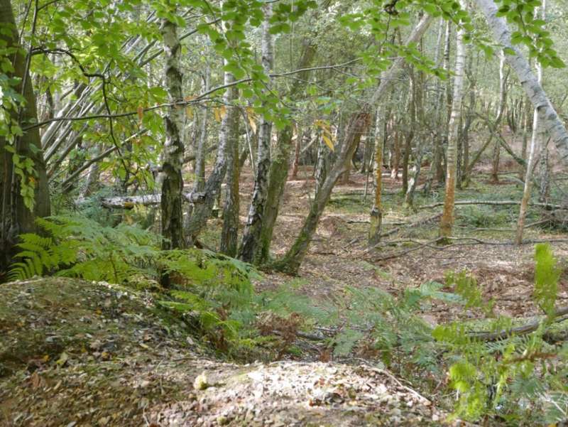
The nature of the terrain varies significantly depending on the amount of recent rainful. On one day the area could be dry, the next covered in surface water. Due to the use of the area as a 4x4 driving area some of the tracks do have deep tyre tracks. If you encounter a flooded track it could be a couple of feet deep in places - although the central part is usually less deep.
Although the most obvious rides have been mapped other ones do come and go in the quarry area so take care.
Dog restrictions
Yes
Facilities
None
Miscellaneous
A reminder to follow British Orienteering Covid-19 guidance
See routegadget page from previous event on the area https://www.so.routegadget.co....
Contacts / Officials
Planner: Jonny Crickmore
Organiser: Neil Crickmore
Controller:
Photo Gallery
click/tap photos for a larger version

